

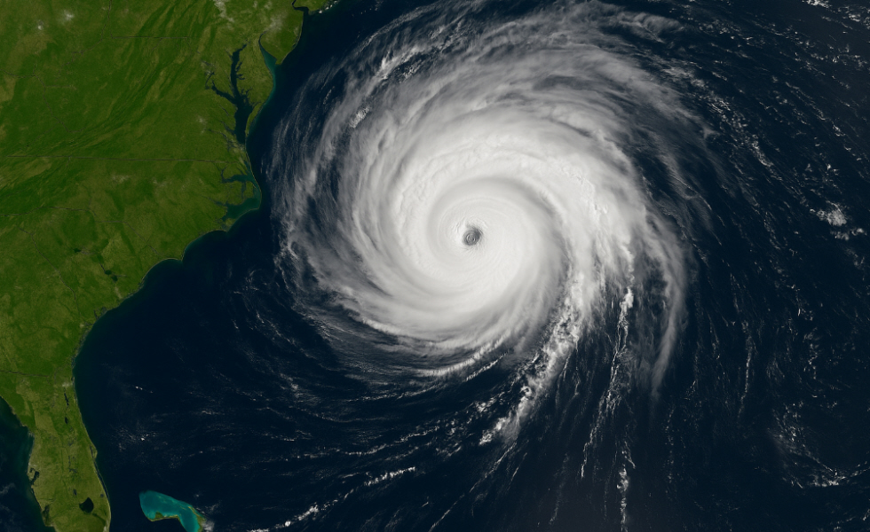
Hurricane Erin has continued to strengthen in the Atlantic, reaching Category 4 status with sustained winds of 130 miles per hour (215 km/h), while forecasters warn it may intensify further before beginning a gradual weakening later in the week. Although the storm’s eye is not expected to make direct landfall in the United States, its size and power pose a significant threat to millions of people along the East Coast.
The outer bands have already produced torrential rain, flash flooding, and power outages in Puerto Rico and the U.S. Virgin Islands, leaving thousands without electricity. In North Carolina, authorities declared a state of emergency and ordered mandatory evacuations in the Outer Banks, particularly on Hatteras and Ocracoke Islands, where beach erosion and the flooding of Highway NC-12 could leave entire communities isolated.
The storm is forecast to generate life-threatening storm surges, waves of more than 16 feet, and deadly rip currents, not only in North Carolina but along the entire coastline from Florida to New England.
Even without making landfall, the National Hurricane Center warns that Erin’s immense size could impact ports, urban areas, and major transportation routes, with dangerous marine conditions lasting for several days. Meanwhile, tropical storm warnings were issued for the Bahamas, Bermuda, and the Turks and Caicos Islands, which are also expected to experience strong winds, heavy rainfall, and hazardous seas.
Along the U.S. coast, residents rushed to supermarkets and gas stations, boarding up windows and securing boats, while local authorities urged people to follow official instructions and not underestimate the effects of a hurricane that, even without landfall, has the potential to cause severe damage to infrastructure, transport, and essential services.